MapSVG
Interactive Vector / Image / Google Maps
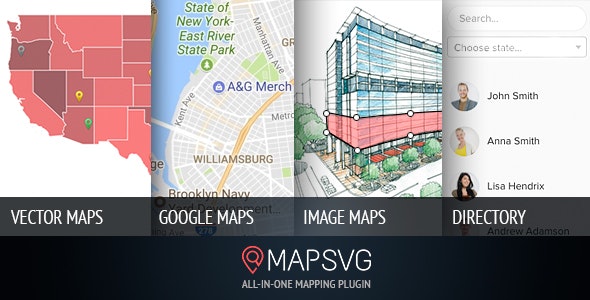
MapSVG features
- Interactive maps of USA, Germany, France, Spain, Netherlands, and 100+ more countries are included.
- Turn any vector image into an interactive map. Draw your own map, floorplan, or any other image which you want to make interactive.
- Create image maps. Use built-in drawing tools and add clickable shapes to JPEG/PNG images.
- Use Google Maps on their own or extends the functionality: overlay one of included vector maps or any other vector artwork on Google map.
- Create custom objects and show them on a map. Add custom fields: text, image, select, radio, checkbox, wp_post, date.
- Show a list of custom objects in a directory with search and filters.
- Add markers to a map simply by entering an address.
- Add filter by distance. Search for nearby locations.
Junior
- File downloads:
- Valid:
Pay with
Developer
- 30 monthly downloads
- +5 downloads on each automatic renewal
- (Optional) Refill the number of downloads for a flat fee
Subscribe
We serve cookies on this site to analyze traffic, remember your preferences, and optimize your experience.